


Aerial photographs of Adak, Alaska (52 North 177 West) during an experiment to see if I could survey Bald Eagle nests from the air. In forested areas this is not very successful; but since Adak has no native trees (there is a tiny planted forest called the "Adak National Forest") it is easy, with reasonably high resolution film and a motor driven camera (Olympus OM-1) to make a survey. Also, we looked at the survival barrels and Quonset huts scattered around the island for the use of hikers and hunters.
Photographs by Michael G. Gordon. Permission is granted to reproduce these images with attribution.
Click on the thumbnail for a medium size image (about 500 pixels wide or high)
Click on "Medium" for a medium size image (about 500 pixels wide or high, same as clicking on the image itself).
Click on "Huge" for an enormous image (about 1800 pixels wide or high and about 200 to 400 kilobyte file size).
| Medium-Big (1K x 700) Introduction slide (date, pilot, photographer) with ground view. |
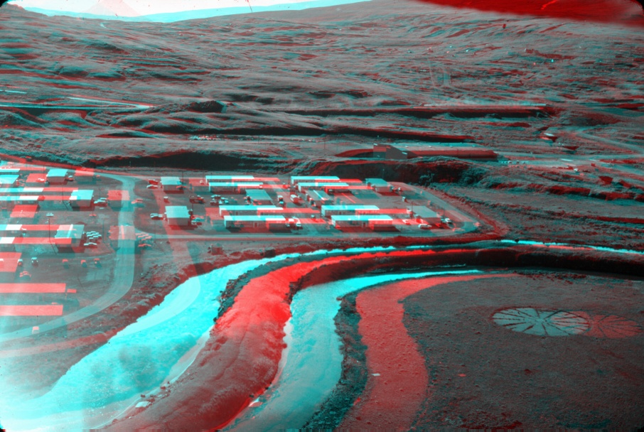
| Medium Huge (1K x 700) STEREO ANAGLYPH (left eye RED, right eye CYAN). View westward from the west end of runway 4/22 (I think that was the angle) looking at Lower Amulet family housing. To the right is Yakutat Hangar, which contained the various hobby shops (automotive, photography, things like that). |
| Medium Huge View westward from the west end of runway 4/22 (I think that was the angle) looking at Lower Amulet family housing. To the right is Yakutat Hangar, which contained the various hobby shops (automotive, photography, things like that). |
| Medium Huge A view (also westward) from the south end of runway 0/18 at the Bachelor Officers Quarters and Upper Amulet (also known as Upper Armpit) family housing |
| Medium Huge View southwest over Roberts Housing. The Chief's Club (CPO Club) is in the forground (big square building) near the waterfront. |
| Medium Huge A view southwest looking directly at Roberts Housing. On the left edge is the Small Boat Basin, and the water is part of Sweeper Cove. The Fuel Pier is found in this view. Mitt Lake is just barely visible in the background left edge. |
| Medium Huge As above, but a bit more southward in view. Mitt Lake is more central in this view. Going out of the picture to the left is the dirt road to Finger Bay and Lake Betty. |
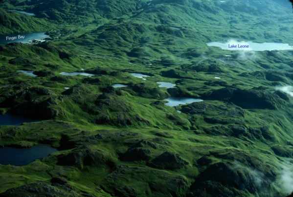
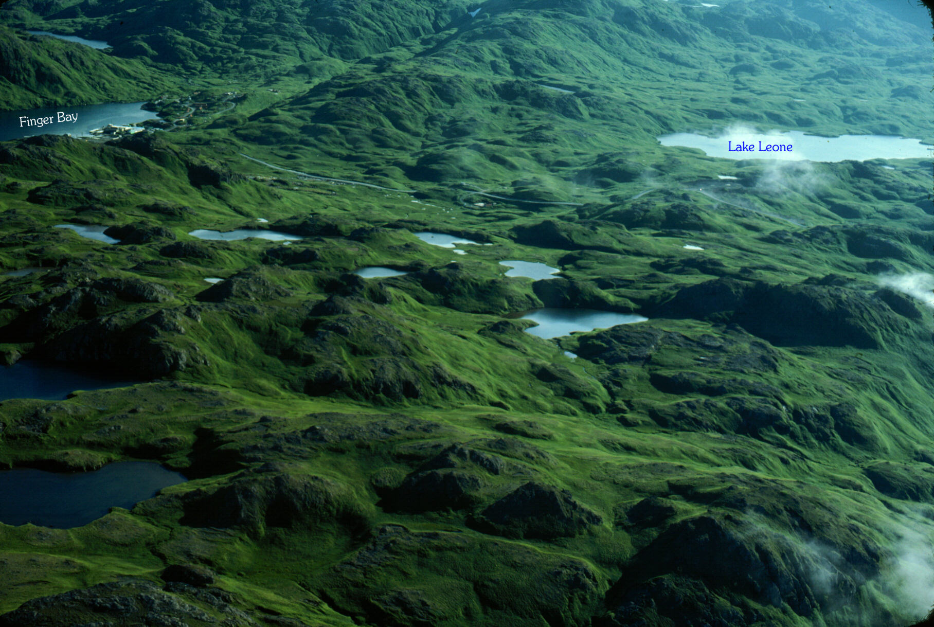
| Medium Huge Flying eastward from Sweeper Cove, we make a photograph southwest over Lucky Point (good day hiking, many small ponds, eagles gather at the edges of these ponds to soak their feet), to Finger Bay. In the upper left corner you get a glimpse of mile-long Lake Betty. The stream coming down from Lake Betty into Finger Bay has fantastic salmon fishing each August. |
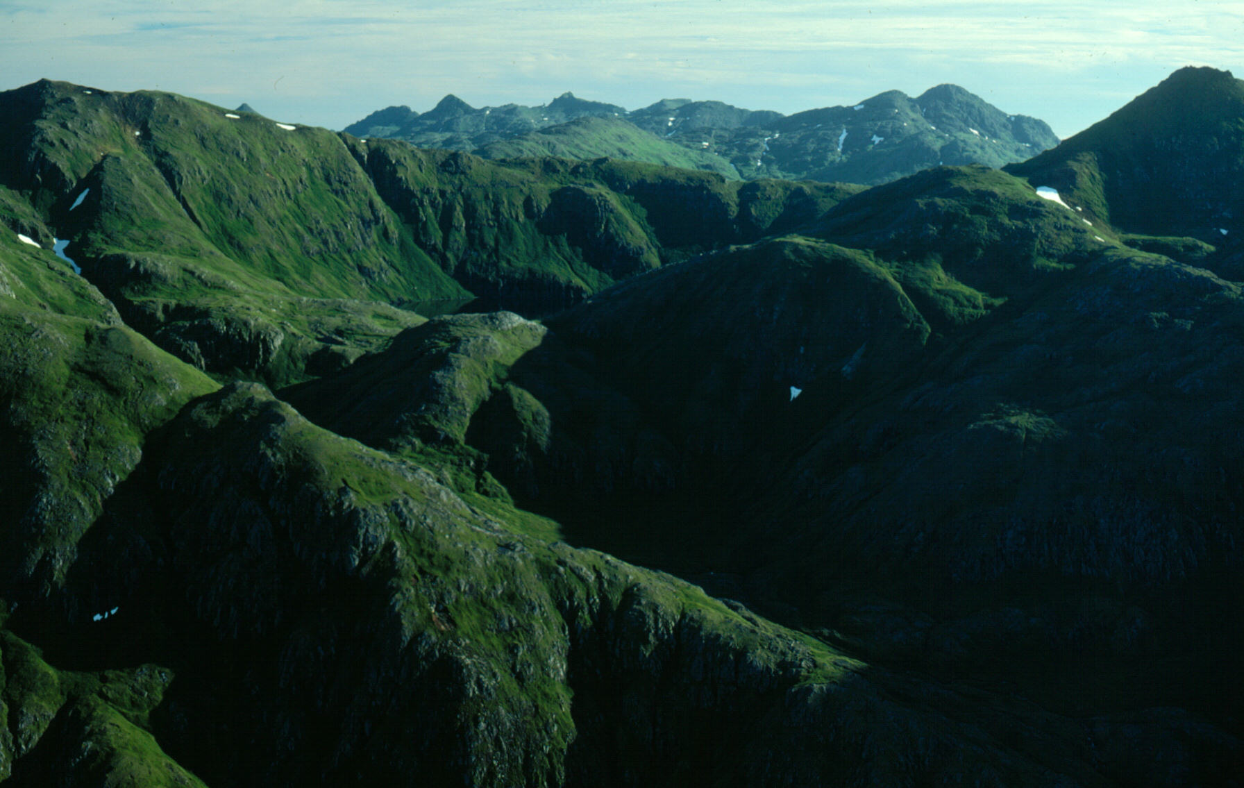
| Medium Huge A view southward of the mountainous area east of Lake Betty, but (I think) not so far east as Razorback Mountain. The highest points on this photograph are about 1800 feet above sea level. |
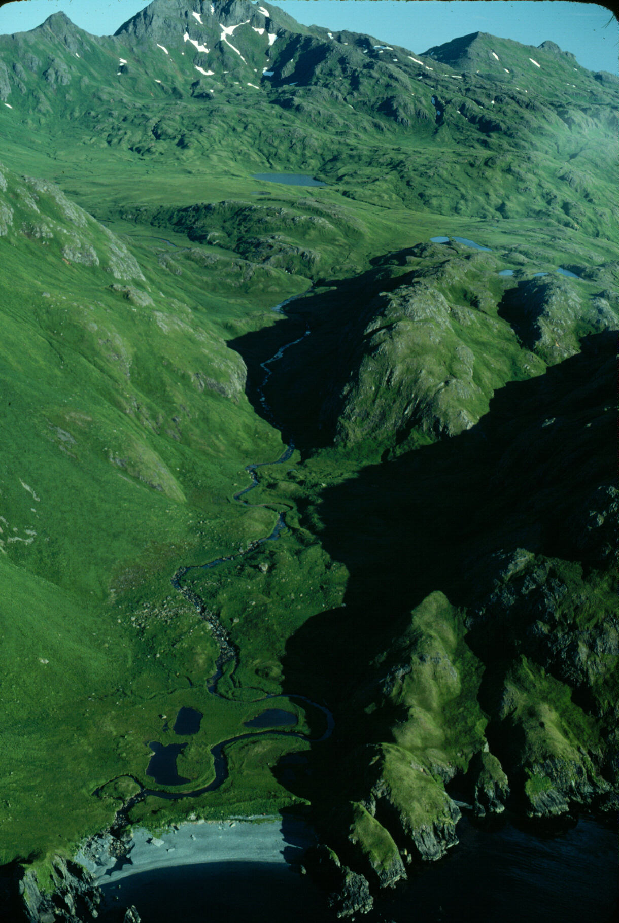
| Medium Huge A view south-southeast over a stream that comes down to the sea, forming a tiny beach. This is, I think, east of Razorback and west of the mountains guarding Hidden Cove. The mountains in the background are the ridge that parallels Kagalaska Straits (which connects the Bering Sea to the Pacific Ocean and which separates Adak from its neighboring island to the east) |
| Medium Huge Now we fly east around the big lump of rock that plunges down into ... Bay (darn, there goes another brain cell!) Oh yes, Kuluk Bay. We were flying along the south edge of Kuluk Bay, which is the north edge of the eastern part of Adak. The view is to the southeast |
| Medium Huge This is a view southward, more or less (a wee bit eastward) over Blind Cove or maybe Hidden Cove. Kagalaska Straits is visible in the background, and way back and comprising the horizon is the Pacific Ocean. Note the cleaned cliffs near the waterline. Note that in the cove it is not so high cleaned. The waves crash on the north facing cliffs very high; being as they are exposed to the Bering Sea's winter storms. Waves crash 30 to 50 feet high along these cliffs. |
| Medium Huge Looping around the island, now heading south along Kagalaska Straits. The view is south-southwest looking at Adak's easternmost north-south oriented mountain range. Notice the two salt-water coves in the foreground; very good for Halibut fishing in the straits and these coves. |
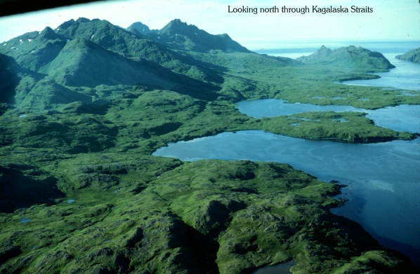
| Medium Huge Looking back (northward) through Kagalaska Straits; Adak is on the left. You now have a better view of the choke-point of the straits near the north end where it opens into Sitkin Sound (the 20 mile space encompassed by Sitkin Island to the northeast, Kagalaska Island on the right, and Adak on the left). It is NOT a good place to be during a storm! |
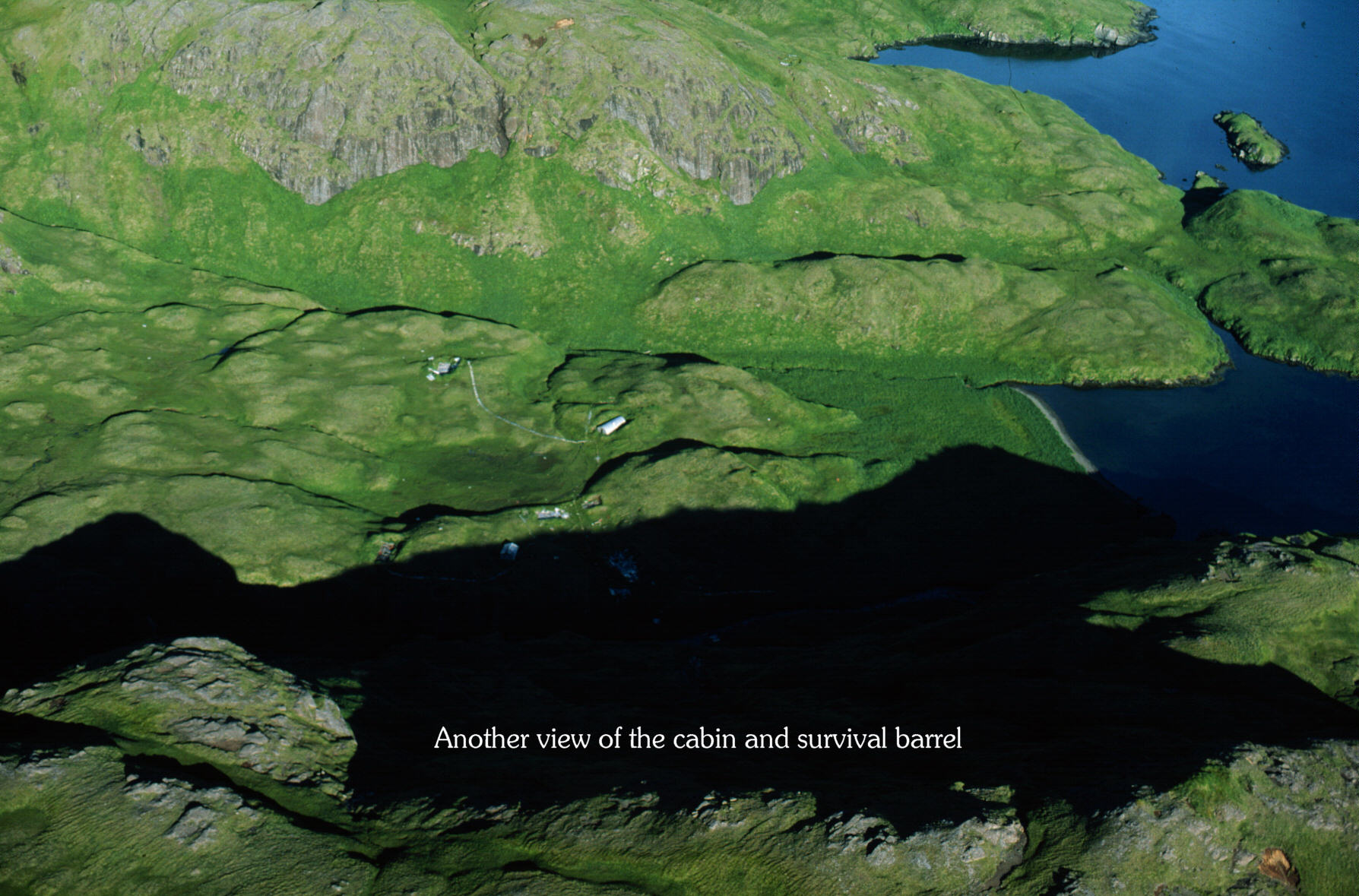
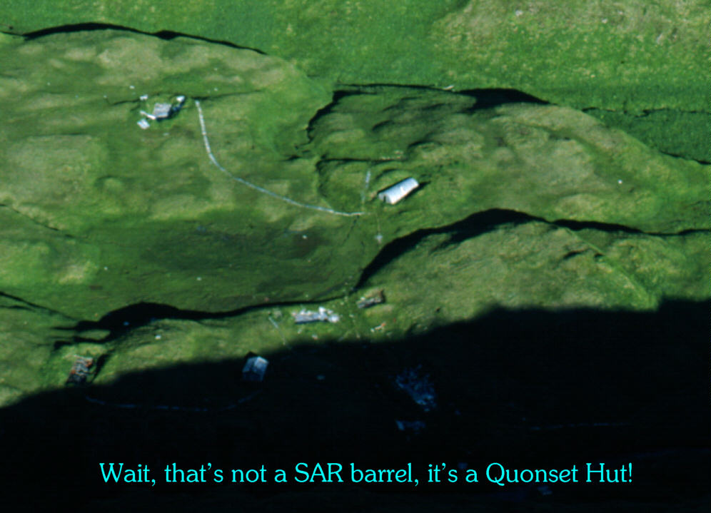
| Medium Huge At the southern coast of Adak exist several cabins, Quonset huts and survival barrels. This photograph is mislabeled as having a survival barrel, but when I scanned it at higher resolution I saw that it was really a Quonset hut partially buried in the tundra. Near to it (foreground) is a small cabin, and remnants of other Quonset huts can be found by following the white (weathered boardwalks) trails. This one is located at the eastern end of Adak's southern coast. |
| Medium Huge A detail view of the above photograph showing the Quonset hut more plainly. |
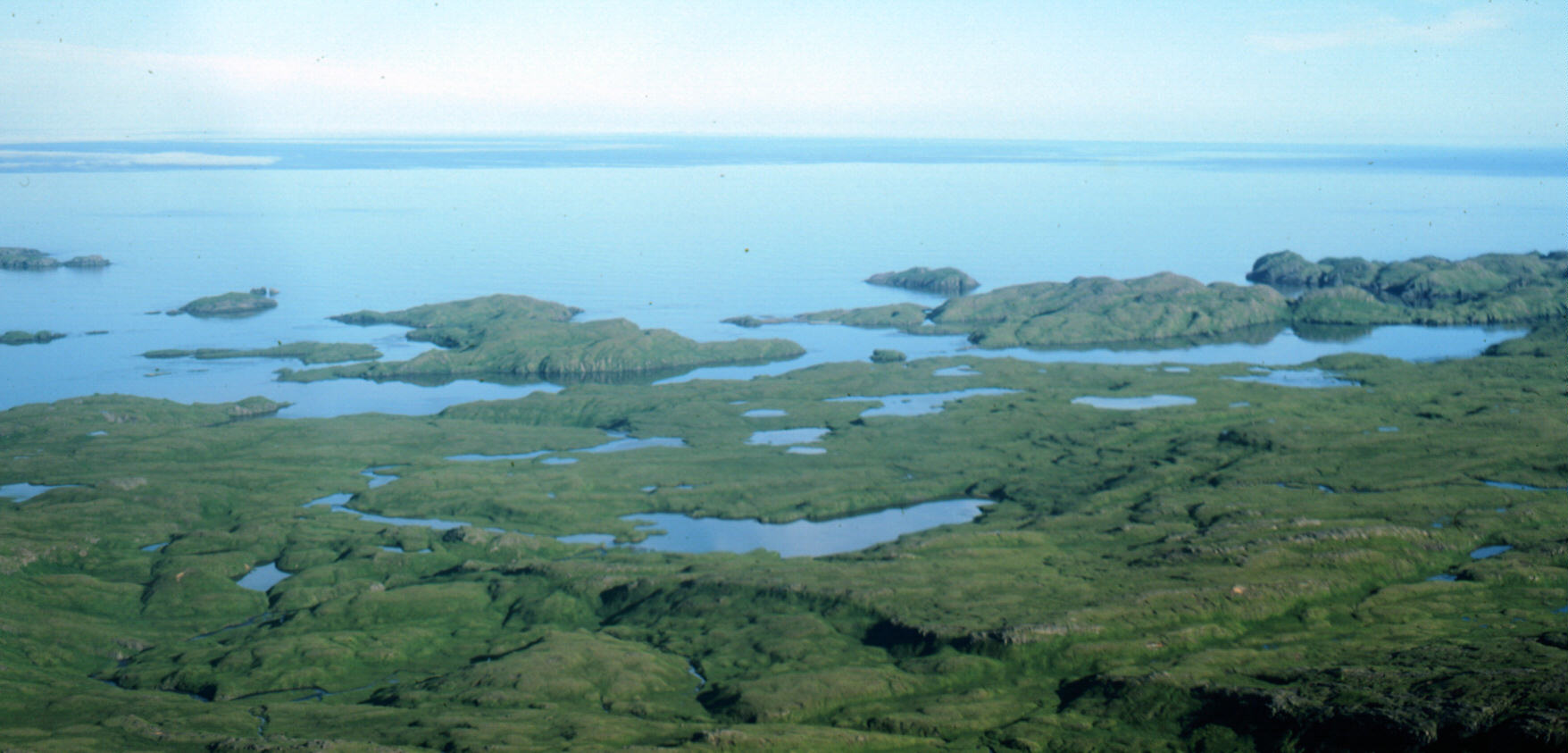
| Medium Huge A view southward of Adak's southern coast, somewhat near the eastern end. This is a good place for Caribou hunting. The close-spaced islets give some relief to small boats traveling around the island. These are very dangerous waters; storms can arise very quickly and the wind can go from calm to 40 knots in about ten minutes (if the reason for the calm is that you are in the eye of a storm cell; and indeed, that is usually the only time you have sunshine and calm is in the eye of each storm as it passes over). |
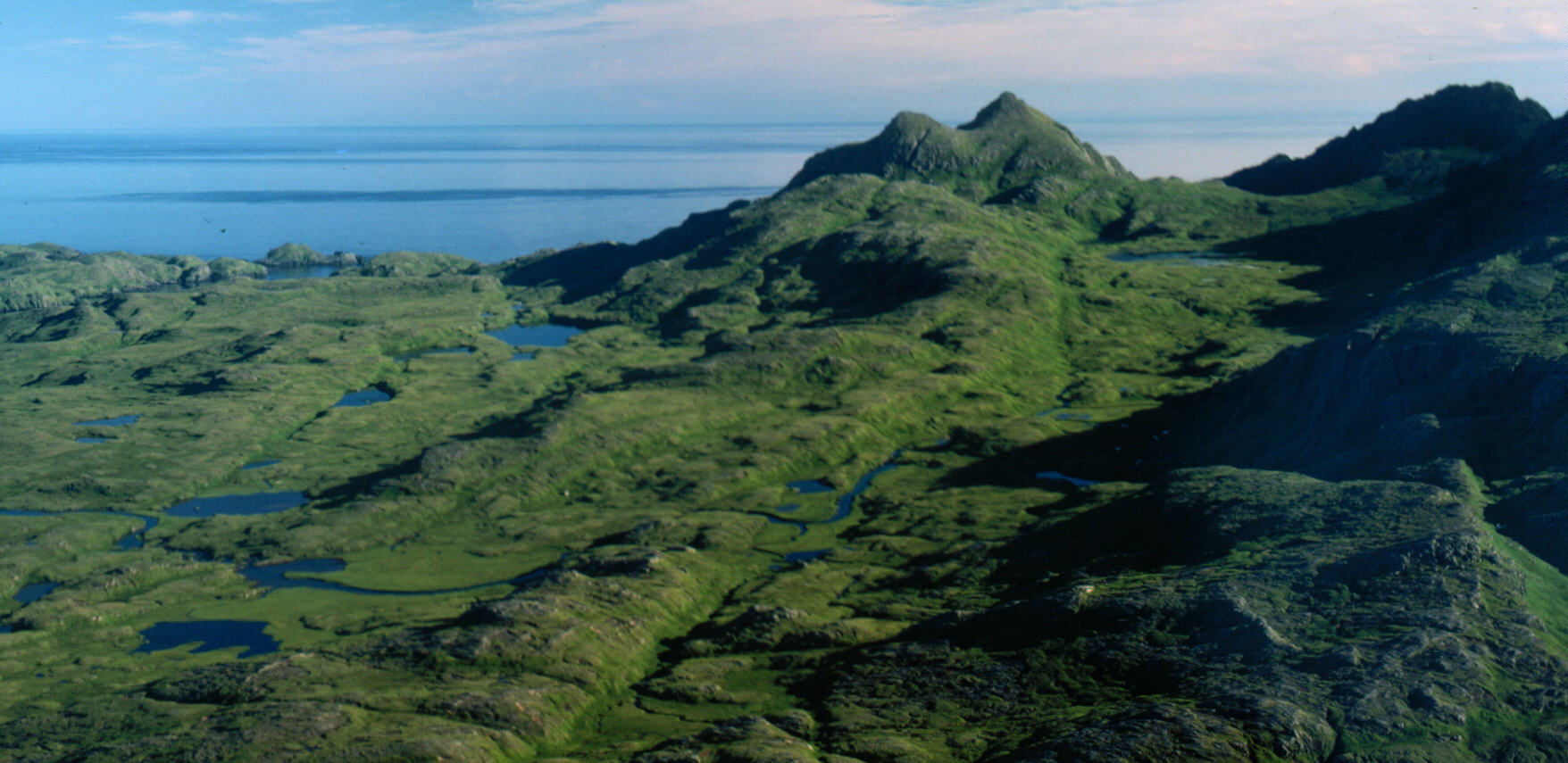
| Medium Huge A good depiction of Adak's tundra. Unlike mainland Alaska tundra which tends to be very boggy, Adak has very lumpy tundra. It is still boggy in places, but is drained by thousands of little streams. This view is southward from a small plain east a few miles from Teardrop Lake. We proceeded southward around the mountains you see on the right. |
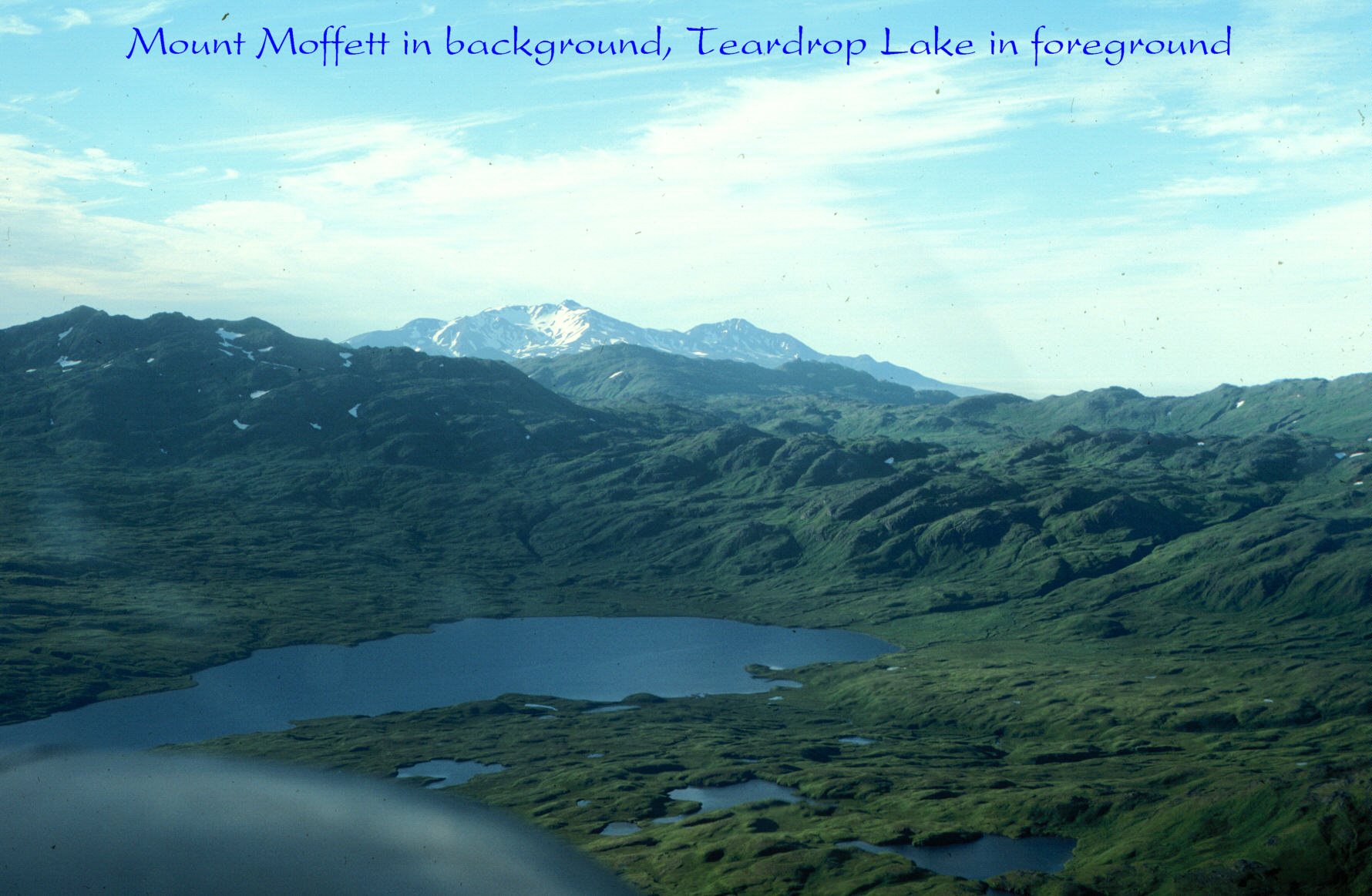
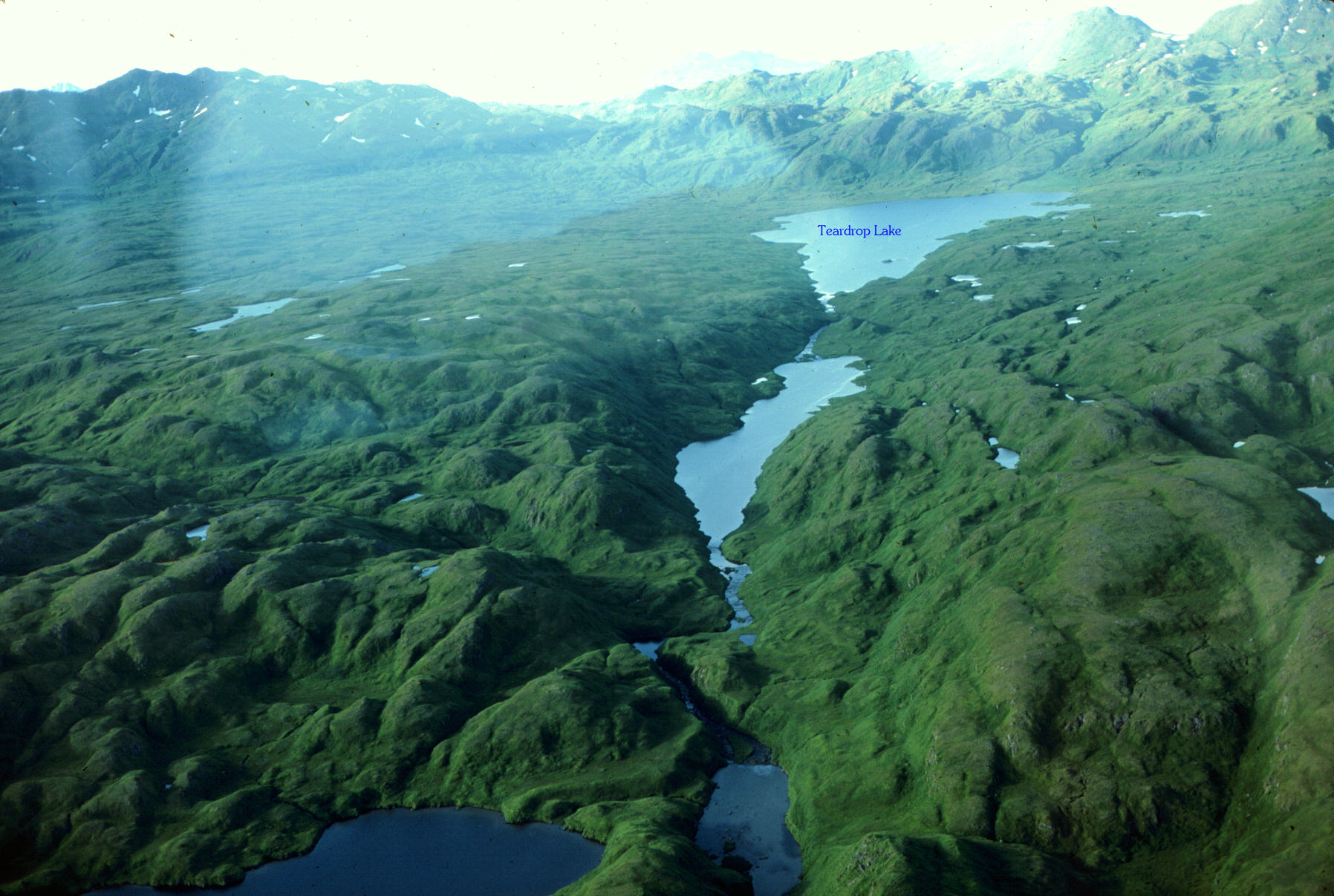
| Medium Huge Clearing the mountains and turning northward again from the southern coast, now positioned over the middle of Adak's southern coast, we have a view of Teardrop Lake and in the background is Mount Moffett, approximately 4,000 feet high above sea level. Teardrop Lake is pretty big by Adak standards, being about 2.5 miles long or so. |
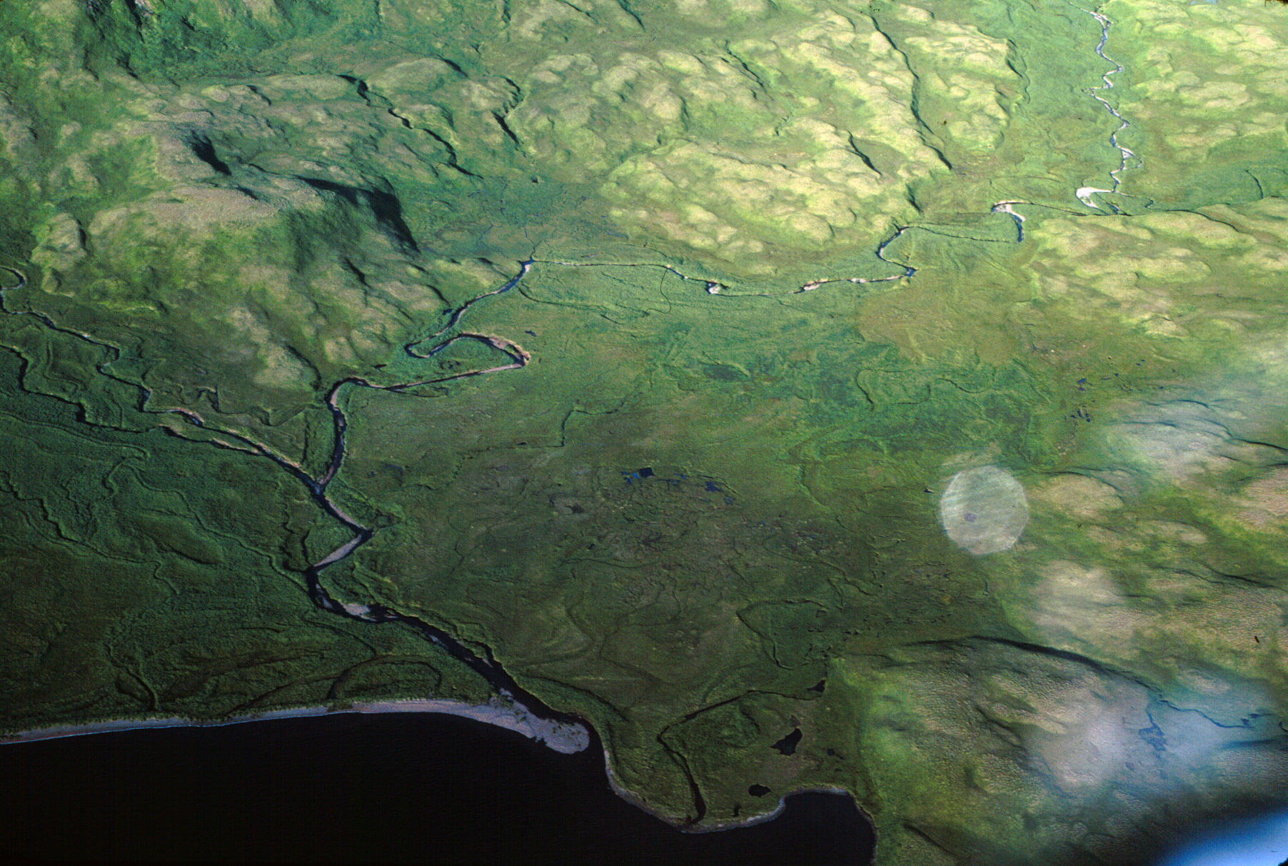
| Medium Huge Another tundra view. This is on the east shore of Teardrop Lake, and shows the boggy nature of tundra as it spreads out on a delta. You can see the s-curves of countless former routes for the stream; and to walk across this area is to get very wet. The grass will be three to four feet tall and usually dripping wet; and underfoot is moss and sometimes the roots are floating on pools of water -- when you step, you can see the grass and moss rippling outward in a wave. Fun, spooky, dangerous, beautiful. |
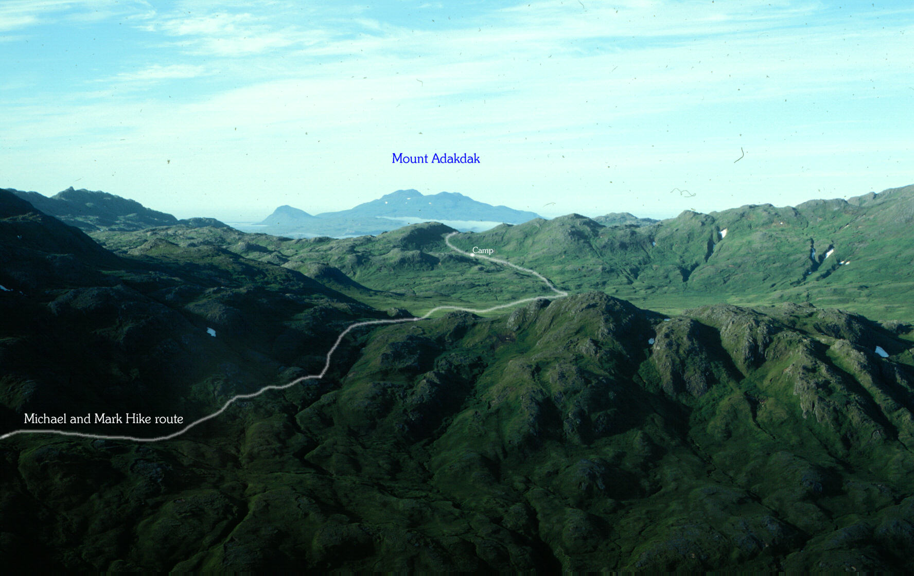
| Medium Huge My friend and I hiked to the southern part of Adak. We stayed two nights at the place marked "camp" in this photograph. The second day out, fog was so thick we could not navigate (now I have a GPS satellite receiver) but we went for a distance anyway; following the contours of the mountain until we came to the southern plains where we had no landmarks. The first night was pleasant, but the second night blew wind about 30 or 40 knots, rained; and the tent filled up with water that was unable to get OUT. I woke up with my feet in four inches of ice water. The wind was blowing so hard, that Mark and I took the same end of the tent, and let the wind stretch it out and we rolled it up in that manner. Three days of soaking wet feet (despite having Trapper Pacs and fresh wool socks) caused the skin on my feet to peel off as though I had leprosy! It was fun, though I don't know how often I would want to do it again. |
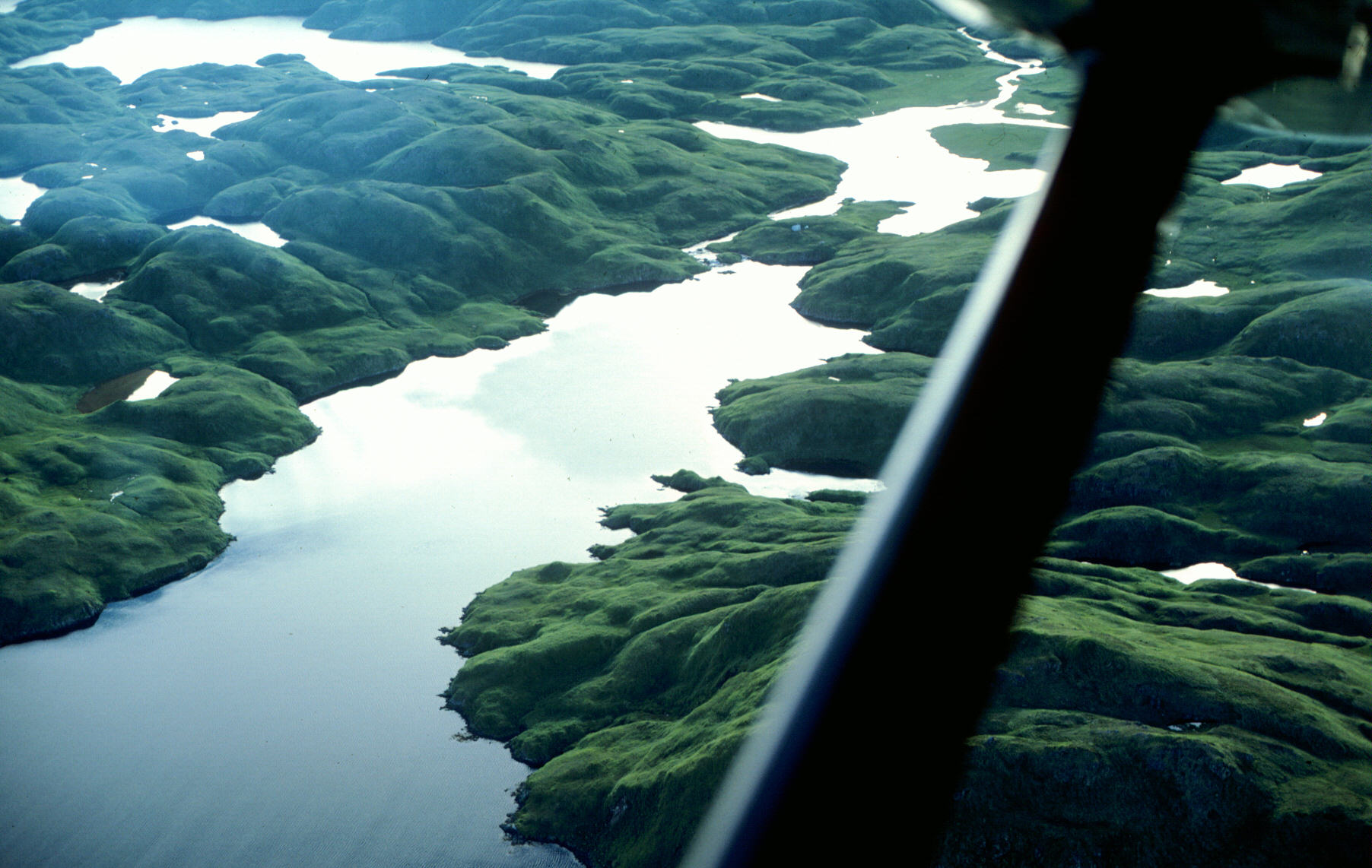
| Medium Huge Thanks to Scott Shock for identifying this one. He writes "This is actually Hidden Bay, with the Hidden Bay cabin on the isthmus." Looking west (and a bit south) over a tiny fjord that first heads north toward Teardrop Lake, then turns west, ending at an isthmus. |
| Medium Huge Looking north at Teardrop Lake and the south-flowing stream. |
| Medium Huge The plains west of Teardrop Lake, good for hunting, adequate for hiking but this is were we sorta got lost in the fog (upper right, near the small lake). |
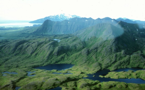
| Medium Huge A view northward from the southwest corner of Adak (excepting the Yakutat Peninsula which sticks out south-southwest from partway northward). Mount Moffett is visible in the background. |
| Medium Huge From the same place as the above photograph, but turned a bit westward. You can now see the north end of Yakutat Peninsula on the left (near side) and on the far right background is a bit of Mount Moffett. |
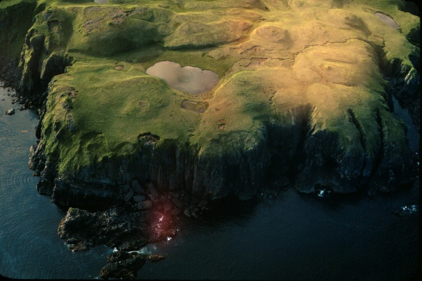
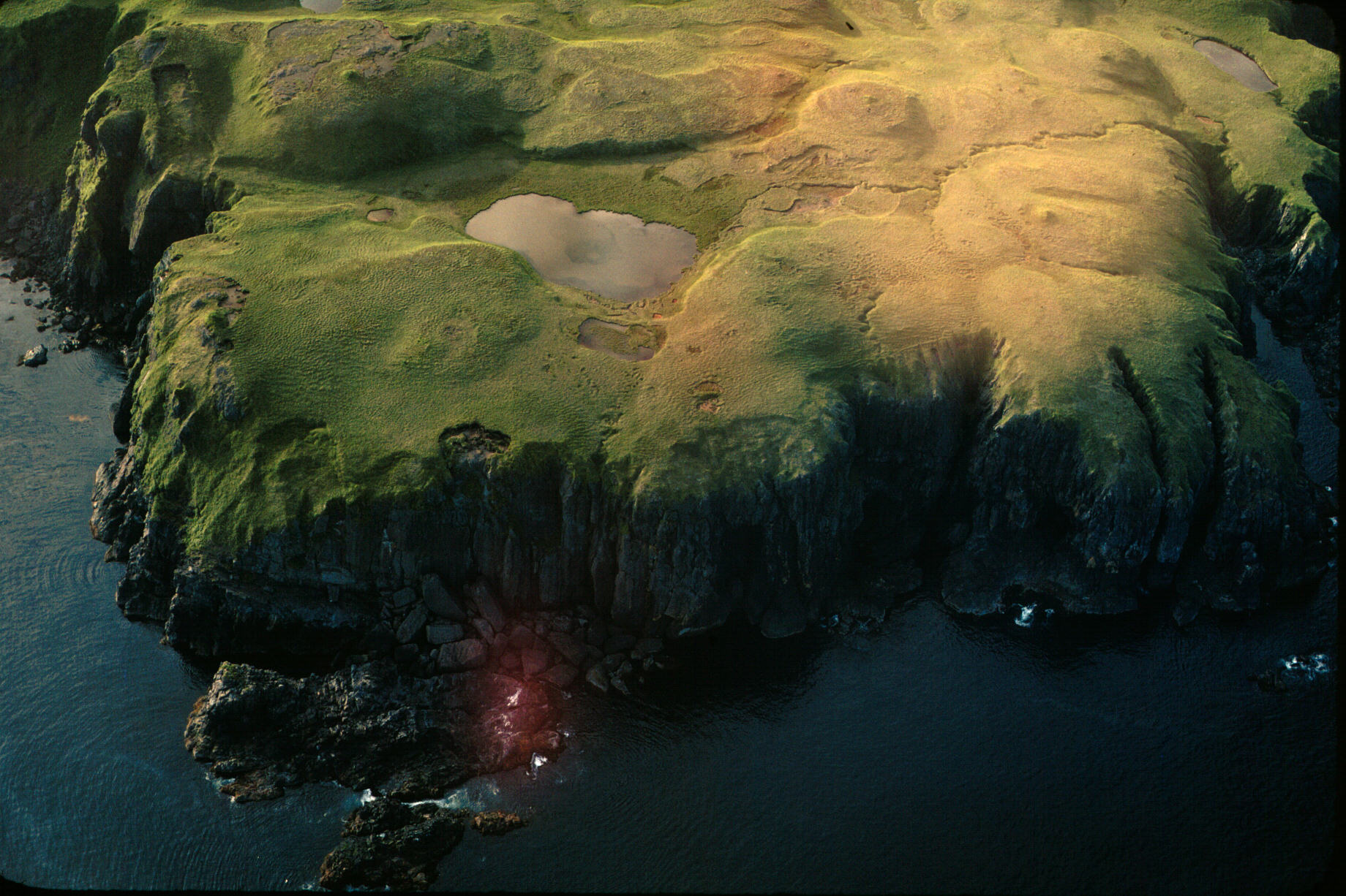
| Medium Huge A view of the cliffs and tundra on Yakutat Peninsula. |
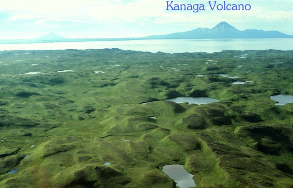
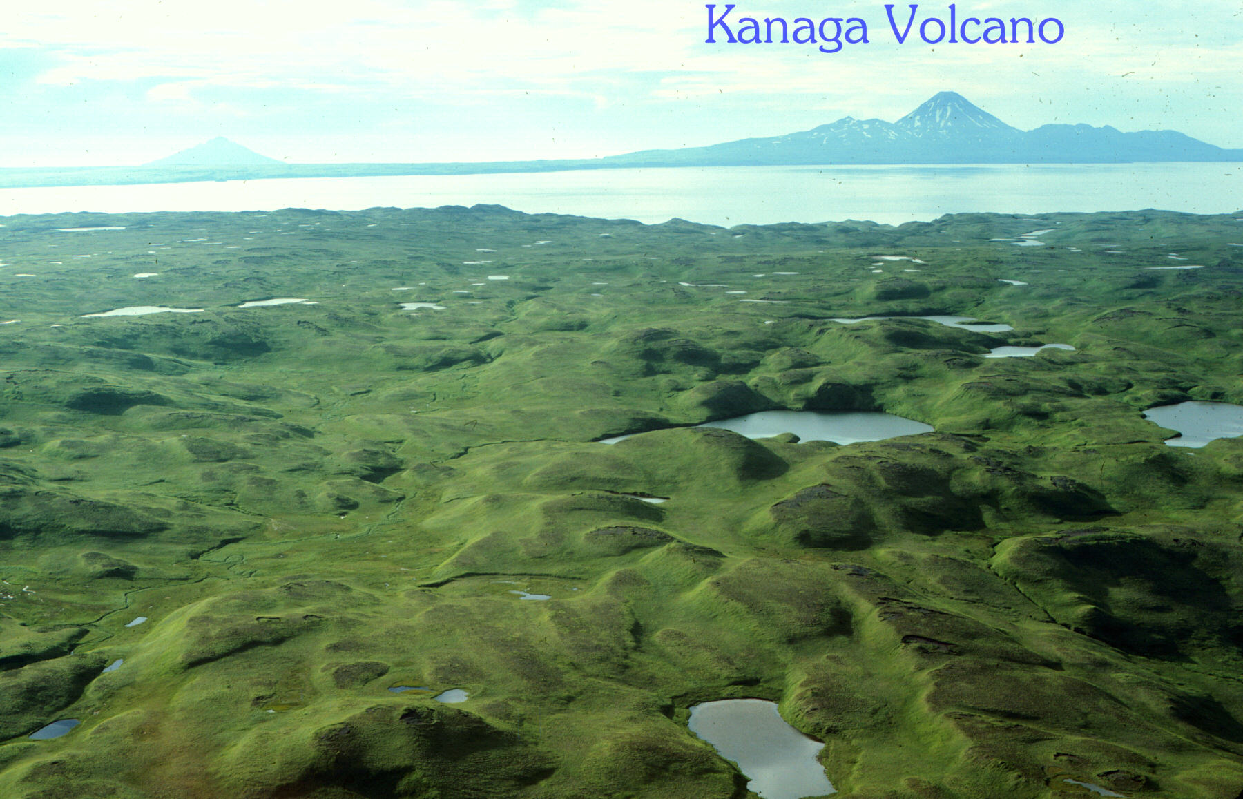
| Medium Huge Another view of the tundra on Yakutat Peninsula. View is to the west and a bit north, includes Kanaga Volcano. |
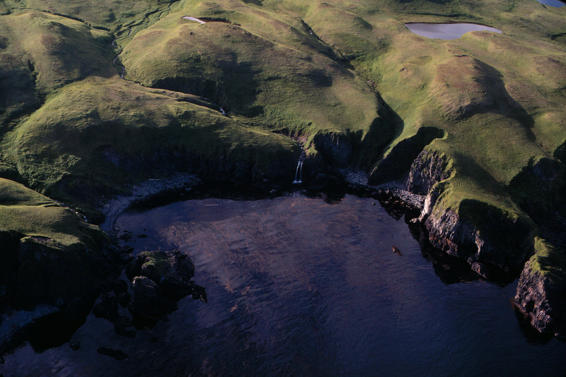
| Medium Huge Waterfall on Yakutat Peninsula. |
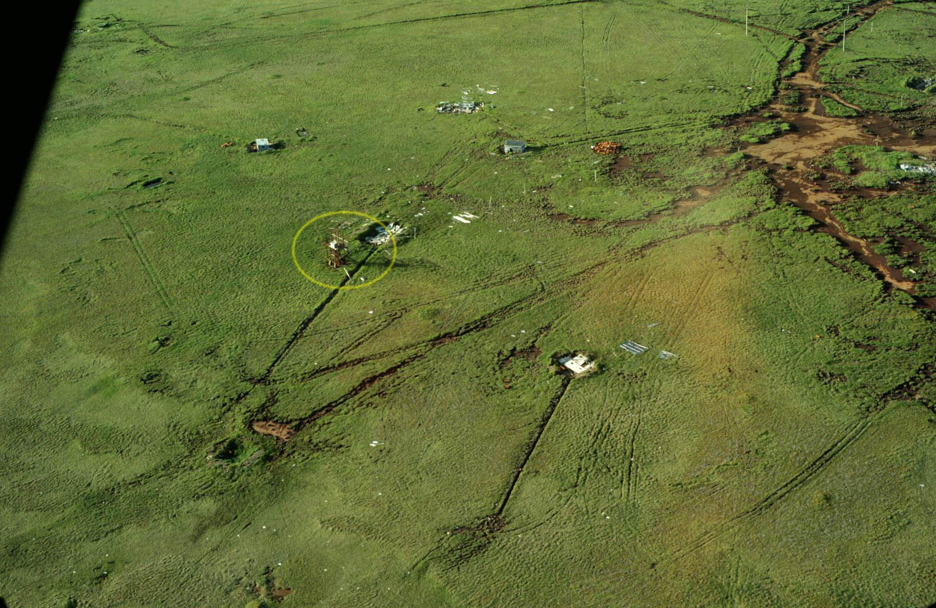
| Medium Huge The old radar (I think) installation at the southern tip of Yakutat Peninsula. Close examination shows that the antenna is mounted on concrete pedestals and does not move; so it might be (1) a communications antenna, (2) early over-the-horizon {communications, radar} or (3) the entire contraption might be the base for a large rotating antenna. Anyway, it is obviously old, probably 1950's vintage, maybe 1960's; maybe as far back as the end of World War 2. If you know more about it, email me or use the contact form on the home page. |
| Medium Huge (1K x 700 approximately) Detail view of the primitive radar (I think) installation on Yakutat Peninsula |