 |
These photographs enlarge to either of two sizes. Click
on the left half of any thumbnail picture to enlarge to about
400 pixels wide, click on the right side to enlarge to 800 pixels
wide.
<Left Column
- Paul Robert's room at NSGA/Commsta
- Looks like propaganda to me :-)
- Shagak Bay, south half, from a vantage point west of Adak
town (the old White Alice radio site).
- Razorback Mountain on the right half of the picture. Same
vantage point west of town looking east (and a wee bit south
of east).
- Visitors looking at Shagak Bay; camera view north to the
lower slope of Mount Moffett.
- Visitors looking at Shagak Bay; camera view eastward back
to town.
Right Column>
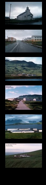
- The old church. In an earlier era (1950's) this church was
down on the flats near what is now the AIMD aircraft hangar a
quarter mile or so south from Birchwood Barracks. It now occupies
the west end of Bering Hill and is listed on the Register of
Historic Places.
- Looking northeast on the back road, Bering Hill. The newest
building, barracks I suppose, is on the left and on the right
exist barracks and the chow hall (EDF, Enlisted Dining Facility).
- A fabulous view of Commsta/NSGA looking across Clam Lagoon
and the backdrop is Mount Adagdak.
- The road to Commsta/NSGA, view is north and perhaps a wee
bit west of north. Mount Adagdak visible in the background. In
fact, it is the background!
- Commsta/NSGA from the back, view more or less southward (and
a bit east). Clam Lagoon is clearly visible and in the distance
the mountains of eastern Adak on the other side of Sitkin Sound
and Kuluk Bay.
- The LORAN station at the northeast tip of Adak. It was abandoned
long before the other facilities on Adak. The advent of GPS
(Global Positioning Satellite) spelled doom for LORAN.
|
 |
 *
* 