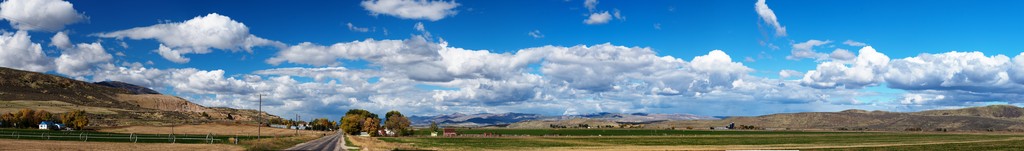
View south at and of Peter Sinks winter recreation area from 41.933827 -111.482650.
Photographed by Michael Gordon. Stiched by the freeware program "Hugin". Click on the huge image to return to this index page.
These images are so wide that they need their own thumbnails just to see what they are!
Permission hereby granted to use these for your noncommercial or educational purposes.
View south at and of Peter Sinks winter recreation area from 41.933827 -111.482650.
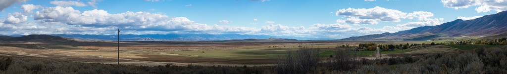
View west to the Wellsville Mountains and gleaming snow.

A panorama view to the northeast to east of Beaver Mountain and Franklin Basin from N 41 53.826' W 111 36.000' (WGS 84).
A panorama view to the southeast of the Bear River Valley northwest of Preston, Idaho; site of the Bear River Massacre of Shoshone.
http://en.wikipedia.org/wiki/Bear_River_Massacre
A panorama view of Cache Valley looking south from the hill east of Newton, Utah.
![]()
A panorama view of Cache Valley looking east to south to southwest from the hill east of Newton, Utah. This contains 43 shots total
and is just over 37,000 pixels wide.
A view northward on the West Side Highway of Cache Valley 3.7 miles north of Dayton, Idaho. The hills to the right were inundated
by ancient Lake Bonneville which suddenly broke loose in an incredible flood, dropping the lake, which covered most of present-day
Utah, by about 400 feet. The last remnant of the flood flowed north through this little valley.
A view of the scouring left by the Lake Bonneville megaflood that poured through here on the way north to the Snake River.
The view is southeast to south. Since the channel is very wide, the scouring is not particularly deep but easily seen on Google
Earth south of Swan Lake, Idaho and a mile or two southeast from Oxford, Idaho.
The water flowed toward us just to the right of the hill called "Little Mountain" (in the center of the photo) just east of
Clifton, Idaho. Unsurprisingly the Union Pacific railway makes use of this channel for its main line from Salt Lake City to
Pocatello. It then spread out in this valley and flowed to the left of the photo, being constrained at Red Rock canyon a few
miles north. As the water drained, the channel narrowed but also speeded up, scouring the bottom of this valley. The last
dregs of the flood took place at N 42 12.915' W 111 59.931'. You can easily see the scour marks and imagine a wide, shallow, relatively
slow moving river spread out across this flat land, meandering a bit before being concentrated at Swan Lake into a narrow
canyon to the north.
http://en.wikipedia.org/wiki/Lake_Bonneville
![]()
American West Heritage Center near Logan, Utah.
![]()
View south from Cedar Mountain to San Rafael Swell (39.175038 -110.639274).
![]()
View north of San Rafael Swell and Buckhorn Wash (39.026705 -110.694489).
![]()
View west from Cedar Mountain in Central Utah (39.305426 -110.831992).
![]()
View east from Cedar Mountain in Central Utah (39.171105 -110.618449).